


Otripy is a desktop application for trip planning. You plan a trip by adding locations on an OpenStreetMap map, each with a note: text with formatting and images. Trips are saved as files on your computer or on a Nextcloud server.
Otripy is developed and used daily on Linux, and packaged for Windows and macOS too.
Otripy is already usable but would be better with a lot of other features. Some wanted features are listed in the issues. Don't hesitate to open a new issue with your ideas, and to contribute them if you can!
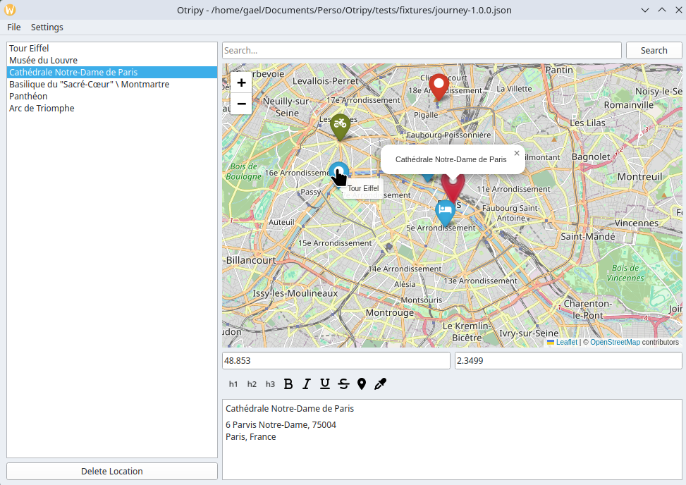
- OpenStreetMap map, with zoom and pan
- Add a location by clicking on the map: its note starts with the place's name and address
- Search places by name and add them from the results
- List of locations, reorderable by drag and drop; the first line of a note is the location's title
- Groups of locations, such as the days of the trip, and notes about the whole trip
- Notes with formatting (headings, bold, italic, underline, strikethrough) and images
- Marker icon and color for each location
- Open and save trips as local files
- Open and save trips on any Nextcloud server you have access to
- Distances and routes between locations, by car, bicycle or foot
- Export to map apps on phones, such as Organic Maps, to use the trip offline during the journey
Ready-to-use installers for Windows, macOS (13 or later) and Linux (AppImage) are attached to each release. Otripy is also on PyPI; with uv:
uv tool install otripy
otripy
See the installation guide for each platform's details.
The user guide explains how to use Otripy, including Nextcloud, and describes its file format.
Contributions are welcome! Translations into new languages are welcome too: see the translators' guide. See CONTRIBUTING.md for the development setup, the tests and the release process, and ROADMAP.md for the planned work. Changes are listed in CHANGELOG.md.
Otripy is Free Software, licensed under the GNU Affero General Public License, version 3 or later. See the AGPL file for details. In summary: you can use it, share it, change it, redistribute your changes, but any version you offer, with or without changes, must be under the same (or a compatible) license.
Otripy is developed and maintained by Kleag. Special thanks to all contributors!
Otripy builds on:
- Map data © OpenStreetMap contributors, available under the Open Database License. Place search and addresses come from OpenStreetMap's Nominatim service, used under its usage policy.
- Routes are computed by the FOSSGIS OSRM servers behind openstreetmap.org, used under their usage policy.
- Maps are displayed with Leaflet, through folium, with markers from Leaflet.awesome-markers.
- Marker and toolbar icons are Font Awesome Free icons by Fonticons, Inc., licensed under CC BY 4.0 (see the icons' license notice).
- The toolbar code comes from Notolog Editor by Vadim Bakhrenkov, under the MIT License (see the notice in toolbar.py).
- The user interface uses Qt through PySide6.
For more information, visit the GitHub repository or the PyPI page.